

AGA TC
By Action Point Innovation Ltd (free)
AGA iTotal control owners can now sync their cookers to their phone, PC, laptop, iPad or tablet. Activate or deactivate the heat and alter the temperature in one or all of the three ovens from anywhere in the world.

My Tide Times Pro
By jRuston Apps (£1.49)
Whether you’re surfing, fishing or simply walking the dog on the beach, My Tide Times Pro works by harnessing information from tidal stations across 25 countries. You can store information, including tide times and sun and moon phases, so there is no need to rely on signal or Wi-Fi.

PeakFinder Earth
By Fabio Soldati (£2.99)
From the Lake District to the Himalayas, PeakFinder Earth uses your location to identify the mountains surrounding you. For high climbers and intrepid explorers, the app will work offline and has a 360° panorama display.

iHandy Level
By iHandy Inc (free)
One for DIY enthusiasts, this is just one of five tools in the iHandy Carpenter toolkit, designed to aid picture alignment and angle and inclination measurement. Comes with a wood-grain background effect.

Dog Tracker Nano
By Fetch Digital Ltd (free; must have a Nano smart tracker)
An app for pets that didn’t pay attention in puppy-training. The tracker, which attaches to a collar or harness, relays real-time information to your phone, from the speed your dog is travelling at to the direction it is going in. For repeat offenders, you can establish ‘geofences’ and receive alerts when they’re crossed.

National Trust Postcards
By The National Trust (free)
Create your own postcards using personal photos of a property or an image from the National Trust’s extensive library. Once you’ve finished customising your creation, the app will print and post it anywhere in the world.

Land Rover InControl Remote
By Land Rover (free)
Connected to your Land Rover, this app can monitor remotely the car’s fuel levels, mileage and check for any dashboard alerts. It also pinpoints the vehicle’s location, in case you lose it in a particularly large car park, and sends aid requests in the event of a breakdown.

Farming weather forecast
By New Holland Agriculture (free)
Data is pulled from more than 71,000 global weather stations to provide up-to-date and accurate forecasts for specific locations. Information available includes evapotranspiration and historic average temperatures.

ChirpOMatic UK
By iSpiny (£2.29)
Hold your phone up in the direction of birdsong and, within 12 seconds, this app will analyse the noise and identify the bird. Notably, there’s an optional bird-safe mode, meaning that all sound playback will be done through the phone, rather than on loudspeaker, to prevent the disruption of wildlife.

FishBrain
By FishBrain (free)
Follow and connect with like-minded anglers, track your catch by species and location and upload your progress to the app. You can also prepare for forthcoming excursions with information on the weather, sun phases, water type and temperature in popular fishing locations across Britain.

Golf GPS & Scorecard
By Swing by Swing Golf (free)
Compatible with every golf course in the world, the app offers a digital scorecard, stores play statistics and handicap progress and has a GPS rangefinder. This measures the distance from your tee-off position to the centre of the green and provides satellite images of the hole you’re playing on.

LeafSnap UK
By Columbia University, University of Maryland and Smithsonian Institution (free) Developed in conjunction with the National History Museum, LeafSnap UK uses visual recognition software to help you identify tree species, matching photographs of leaves to its 156-strong tree database. Once identified, you can label and map the location of individual trees.

-
 A Grecian masterpiece that might be one of the nation's finest homes comes up for sale in Kent
Grade I-listed Holwood House sits in 40 acres of private parkland just 15 miles from central London. It is spectacular.
-
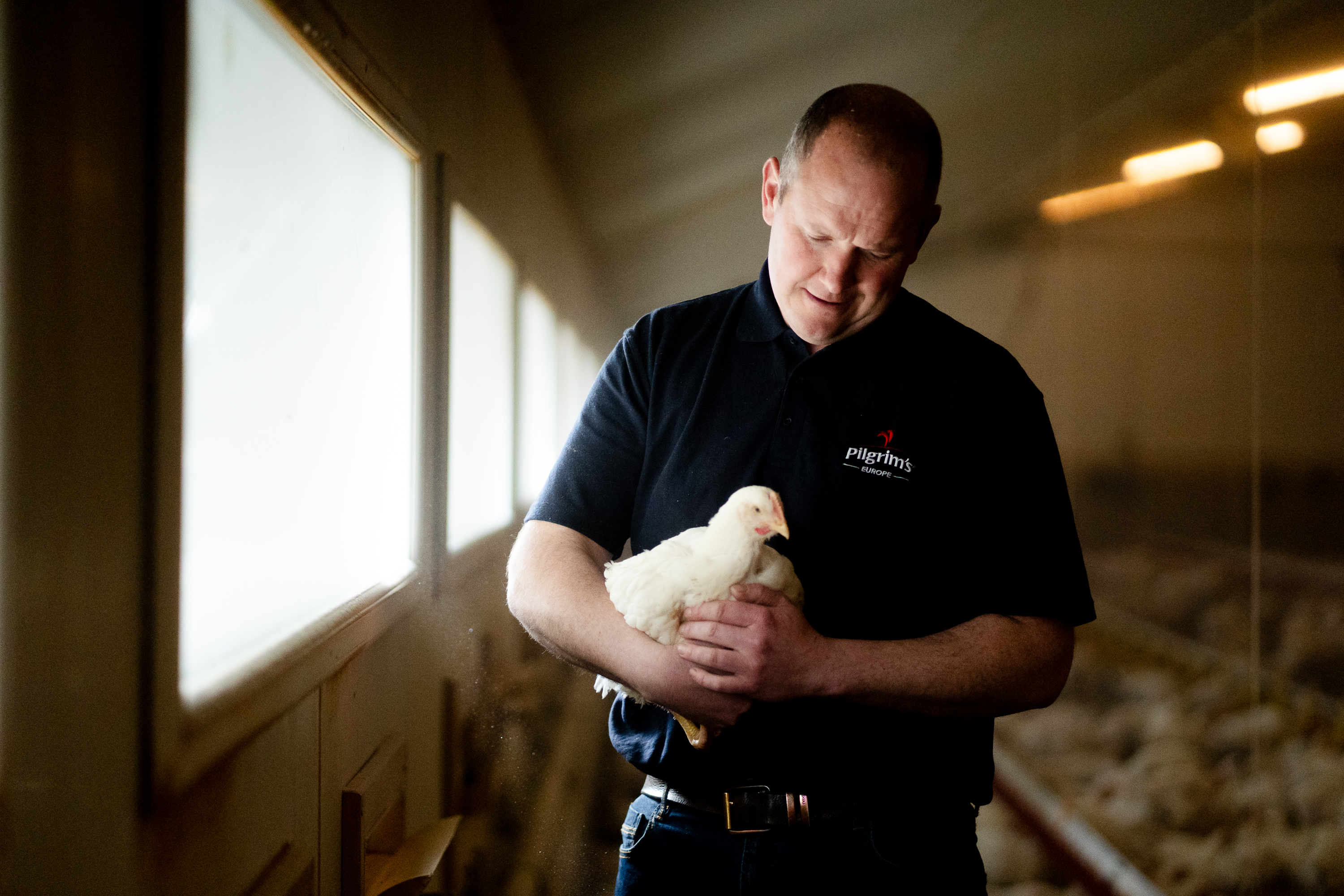 What the cluck? Waitrose announces ‘trailblazing’ pledge to help improve chicken welfare standards
Waitrose has signed up to the Better Chicken Commitment, but does the scheme leave Britain open to inferior imports?

